Flood control and how to minimise losses


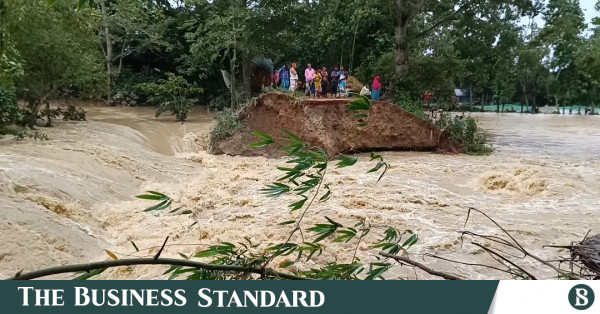
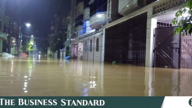
Flood control methods aim to minimise and prevent the detrimental effects of flood waters on road surfaces, human habitats and green spaces. Flooding can be caused by heavy rain or manmade changes to water bodies and water flows.
To control the impact of flooding, countries around the world have taken diverse structural and non-structural types of initiatives.
Reasons Behind Flooding: Why Water Overflows
Flash floods can be triggered by natural phenomena, such as heavy rainfall, severe wind flows above water, tsunamis, cyclones, high tides, etc.
Now, what happens when huge amounts of water rush down? A portion of this water is retained in water bodies (rivers, lakes, canals, ponds, etc), vegetation, and soil surface while some water gets evaporated, and the rest of water passes through surface runoff. Floods occur when water bodies, soil, and vegetation cannot absorb the excess water.
Human activities can influence the creation of excess water or prevent the natural ways of water absorption, retention or run-off. For example, deforestation, inadequate green spaces, failures/breakage/willful opening of dams or barrages, insufficient water reservoirs, impervious or paved surfaces, blocked drainage systems, clogged water bodies, etc can lead to inundation.
Structural Methods to Control Inundation
Structural flood control methods include man-made physical solutions, such as the construction of dams or barrages, water reservoirs, river dredging, planting vegetation, etc. Besides, well-functioning drainage systems, channels to divert flood water, levees (dikes), etc are man-made structures to fight floods.
Barrages or Dams
Dams or Barrages are designed to control the flow of water completely or partially. In the case of large barrages, associated reservoirs are built to create a space to hold the floodwater.
Dams are also used to generate hydroelectric power and water conservation. Construction and designs of barrages and the associated reservoirs depend upon standards set out by the respective governments. Usually, dams and reservoirs are built considering the watershed’s design flow rates, meteorological data, topographic features, streamflow, soil data, etc.
However, dry dams serve for flood control only without any conservation storage.
Diversion tunnels or canals
Flood control tunnels or channels refer to empty large basins where the surface water can flow through. The water will be retained only during flooding periods.
These types of structures also include dry tunnels or channels that are built underground and run below the street levels of cities. When a flash flood occurs the excess surface water is drained out through these underground structures into a sea, river or other water bodies.
In many cases, underground flood tunnels or channels are built on the ancient natural waterways to reduce flooding.
Floodplains and groundwater replenishment
Groundwater replenishment is a great way to utilise the excess surface water. In this method, the flood is diverted onto land so that the soil can absorb excess water. The recharging of groundwater tables not only prevents flooding but also serves as a natural reservoir. People can extract the underground water through pumps during dry seasons or droughts.
River defences
Rivers can cut down the risk of inundation by holding the water. Regular dredging is essential to preserve the navigability of the rivers during flooding. Structures such as reservoirs, levees, bunds, weirs, etc can be built to prevent rivers from overflowing their banks.
Flood barrier
A flood barrier is also known as a surge barrier or storm surge barrier. This structure refers to a specific type of floodgate, designed to prevent inundation in the protected area behind the barrier. Flood barriers can also be built around individual buildings to prevent floodwaters from entering the buildings.
Non-structural Ways to Prevent Flooding & Minimise Losses
Non-structural flood control methods include flood risk management strategies, land-use planning, zoning, flood proofing, flood forecasting, advanced flood warning systems, flood insurance, evacuation of flood victims, rebuilding plans, etc.
Flood mapping
Governments and policymakers utilise flood mapping as a tool to delineate the areas of potential flooding events, assisting planned decisions to prevent extreme flooding occurrences. Flood maps help create documentation for experts and policymakers to make informed decisions about flood hazards. It also generates conceptual models with information for public and private sectors about flooding hazards.
Flood modelling
Flood modelling is another tool that is used to anticipate the severity of flood hazards and their effects on humans and structures. Flood modelling is conducted by combining diverse factors such as terrain, hydrology, urban topography, etc. This technology utilises geomorphic methods, remote sensing, hydraulic models, conceptual models, etc.
Stakeholder engagement
Integrating stakeholder engagement into flood management provides a more complex analysis of the situation and allows enhanced public engagement in policy discussions. This creates paths for collective solutions through greater cohesion and consensus.
Flood risk assessment (FRM)
Flood risk assessment can help to reduce the human casualties, and socio-economic losses caused by flooding. FRM is used to reduce flood risk and manage risks to lives and properties due to flooding.


